
TRACE THE PAST
Golden Triangle | Eden Prairie, MN | 2011
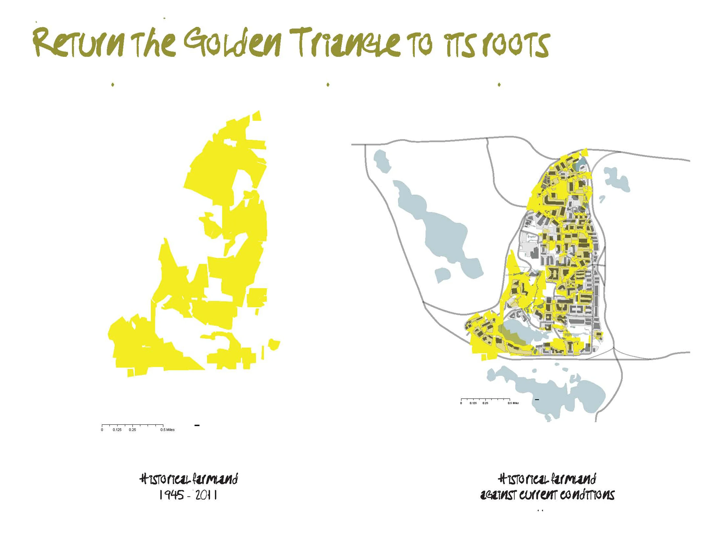
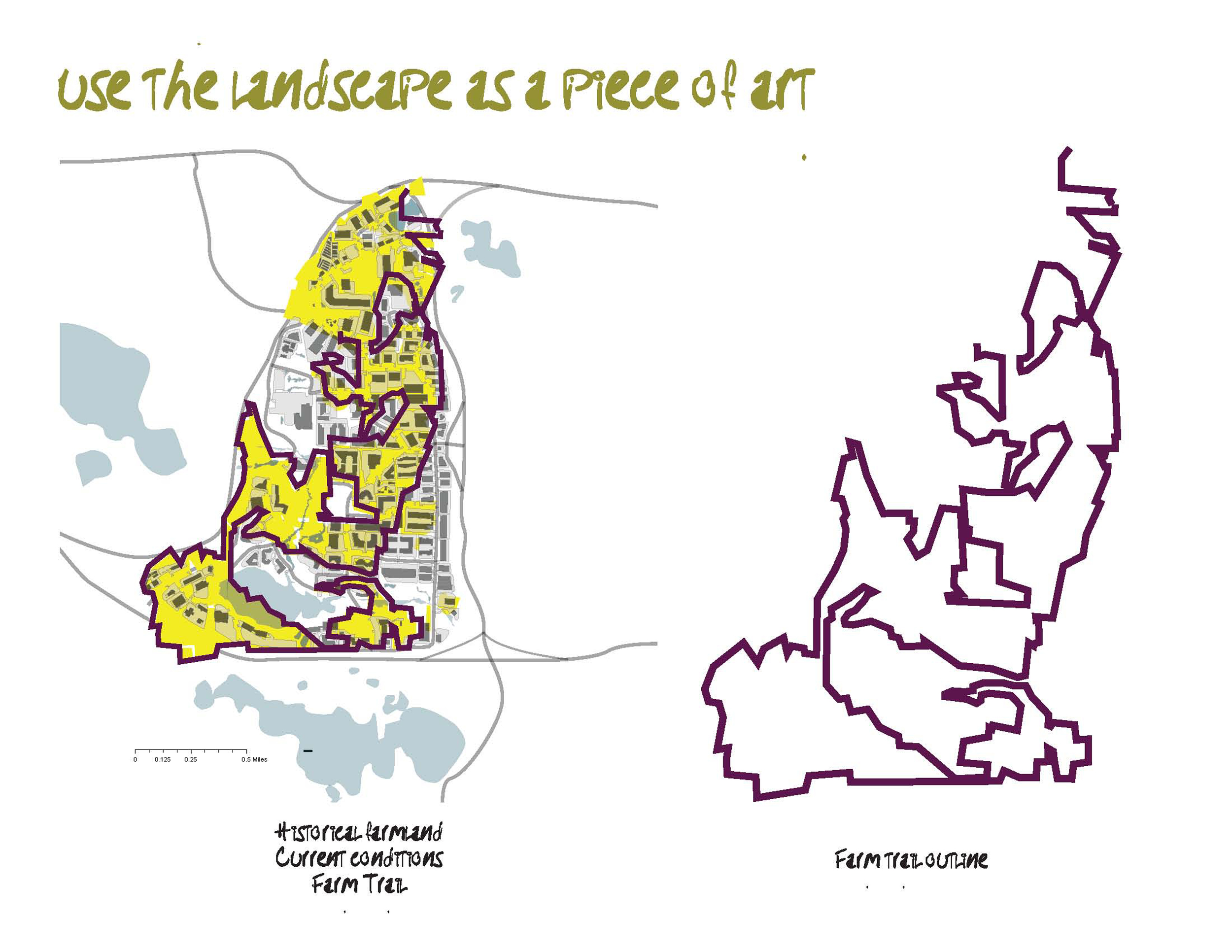

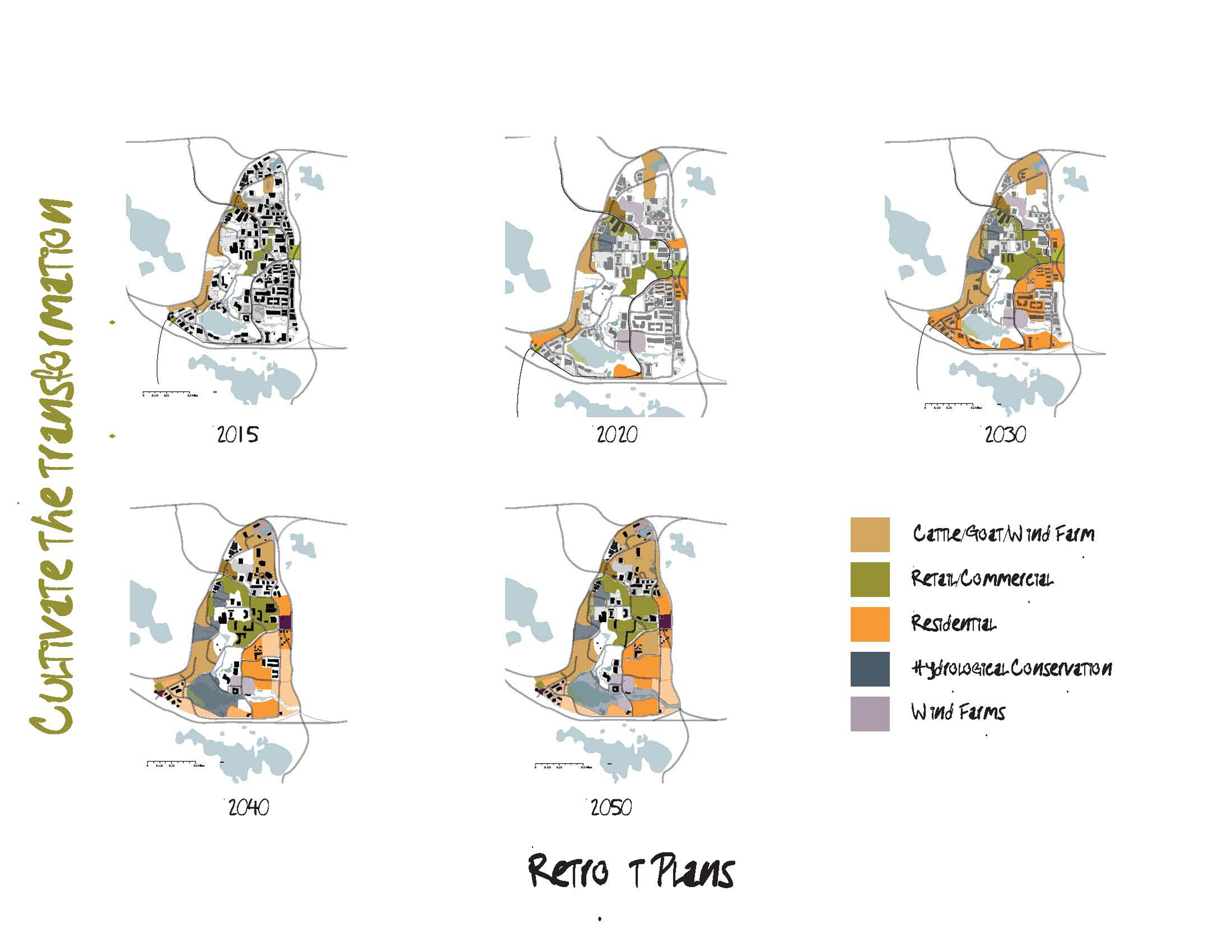
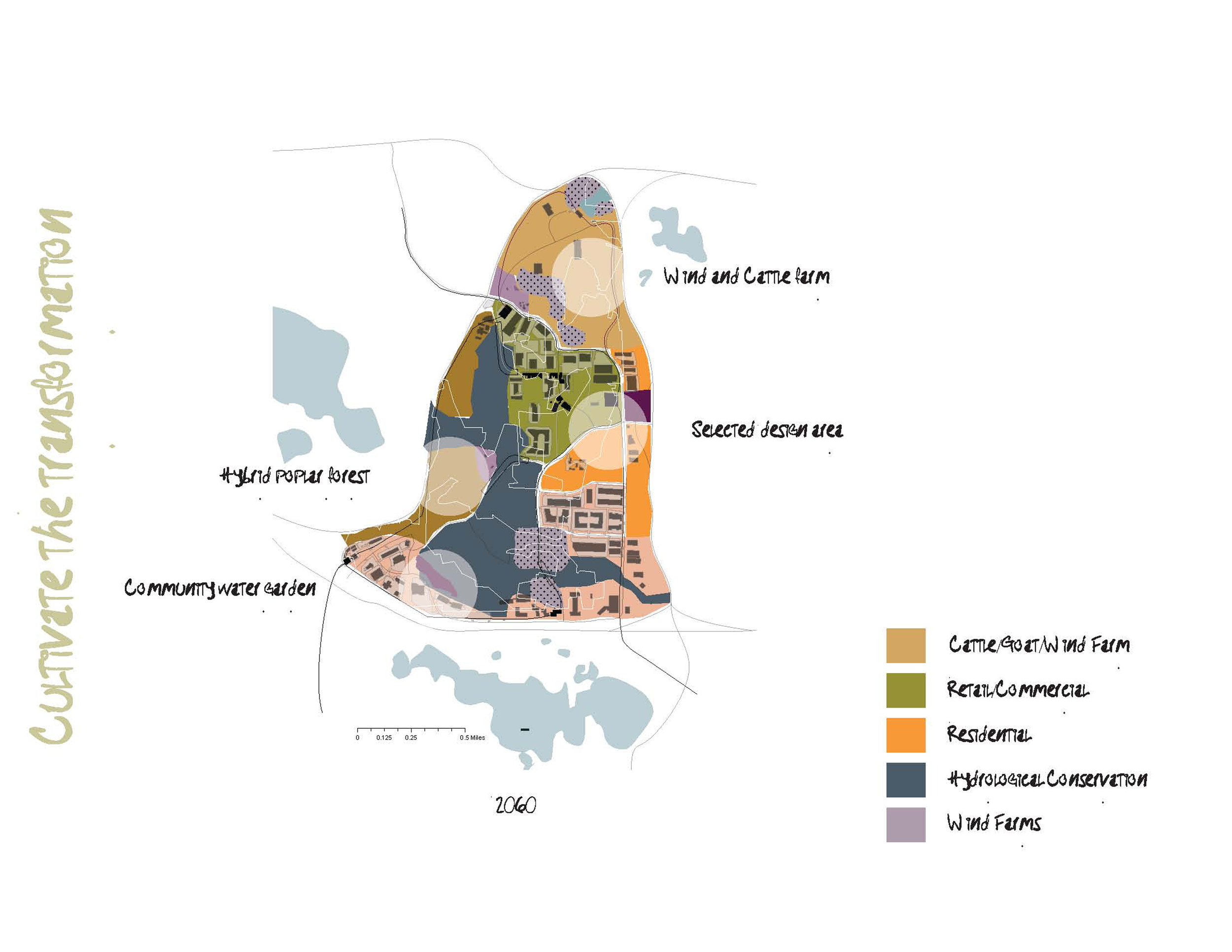


A plan to return the Golden Triangle to its roots, use the landscape as a piece of art, and cultivate the transformation through the community.
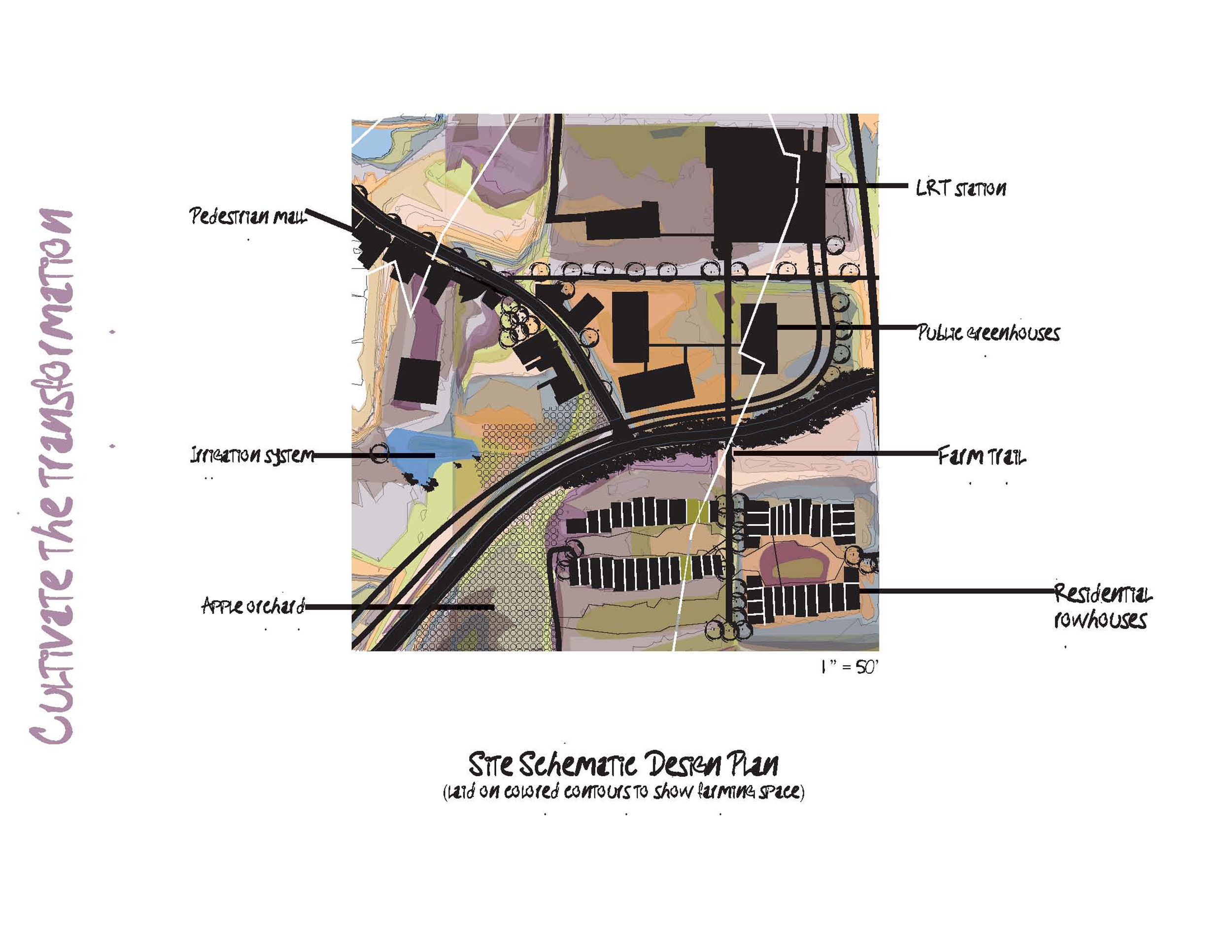
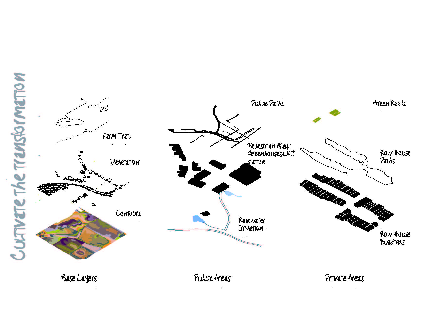
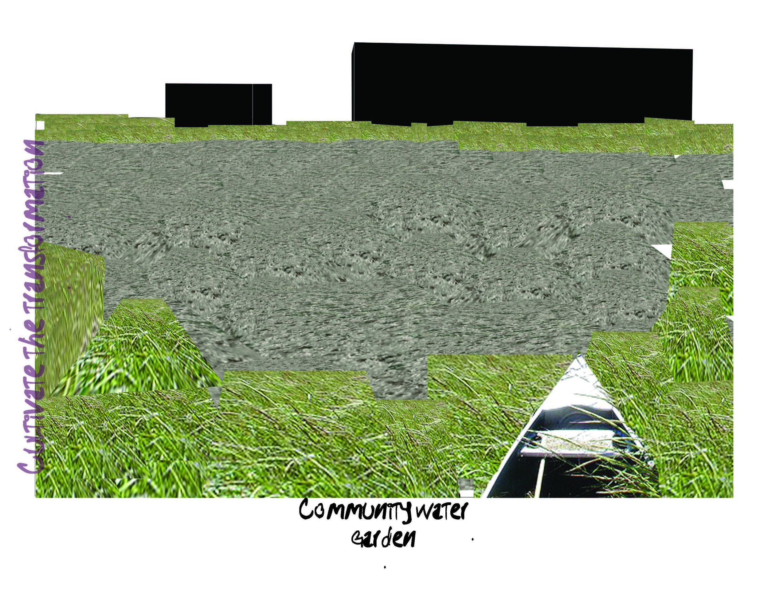
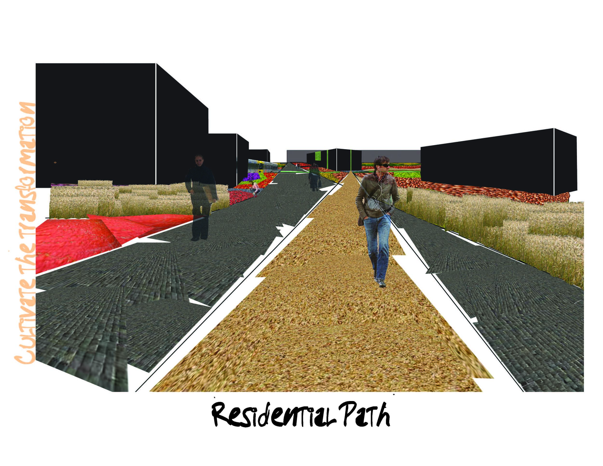
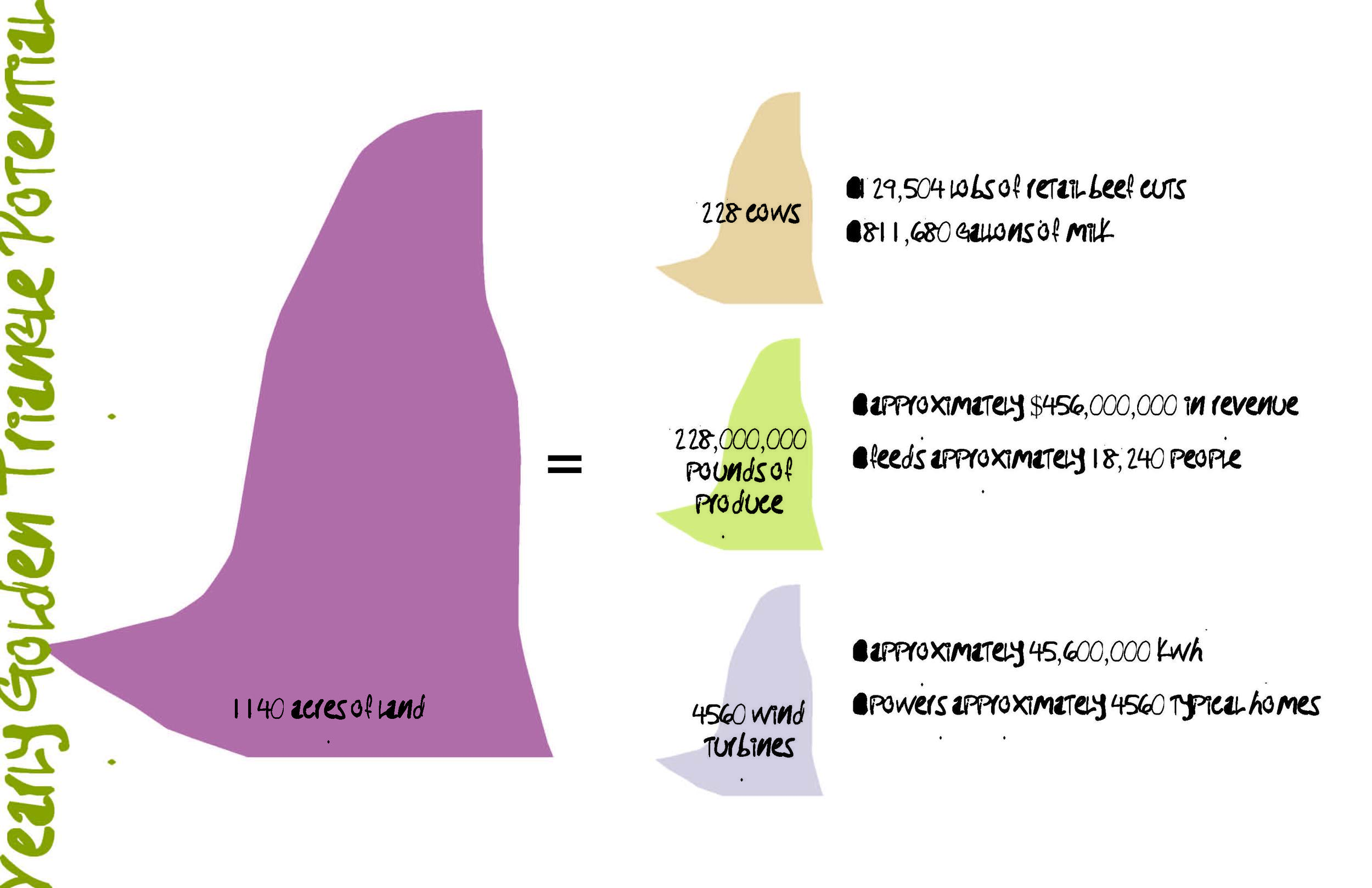
The Golden Triangle was once all farmland, and today only one farm operates within its boundaries. A path has been created through the site by tracing the edges of the farmland that once was. The path crosses through distinct "farm" zones located throughout the site: a water farm for cranberry and wild rice cultivation, a cattle, goat and wind farm on the northern edge of the site, a hybrid poplar forest for biofuel, and the utilization of contour farming methods throughout the rest of the site. The contour farms start out as publicly owned, allowing for all of the area residents to participate in cultivation and harvest.
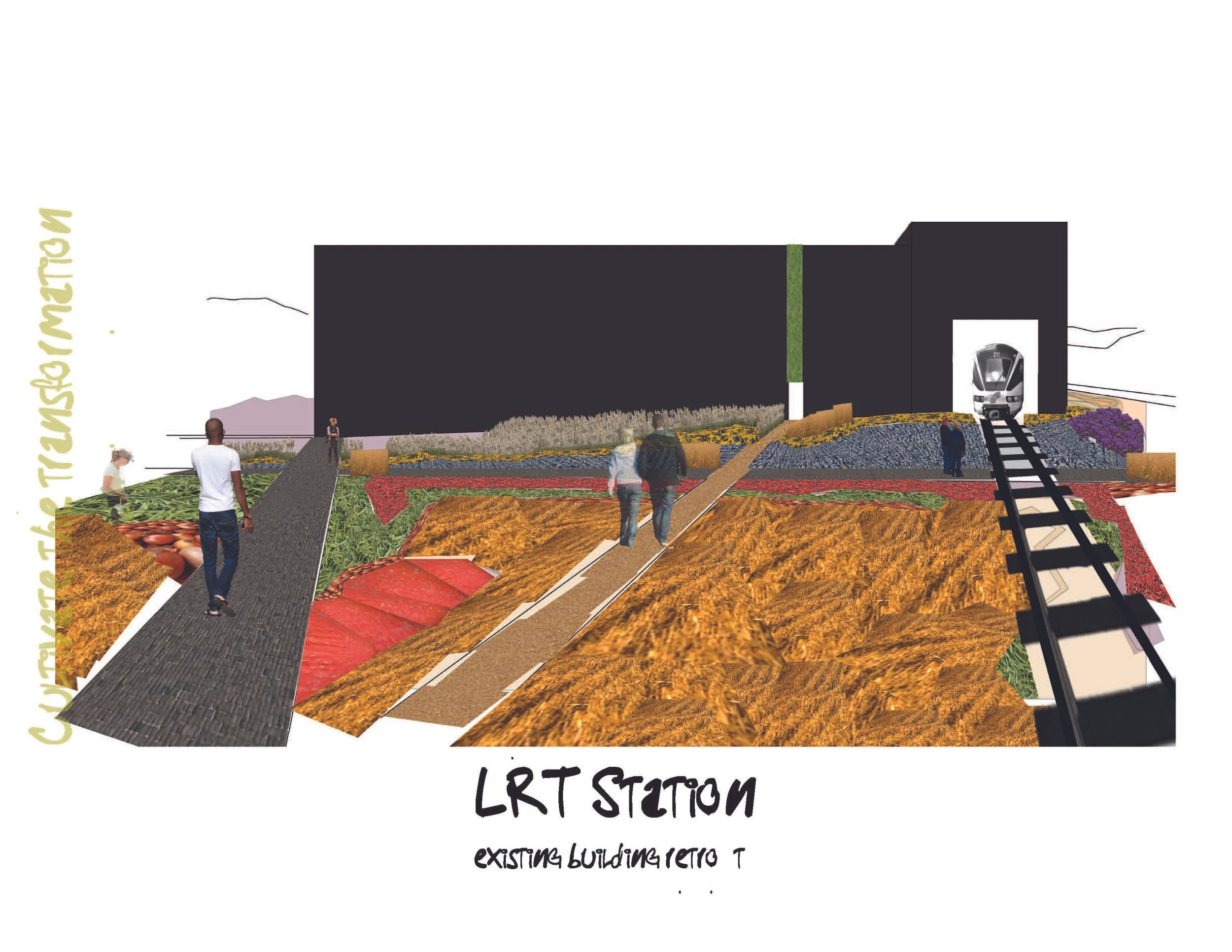
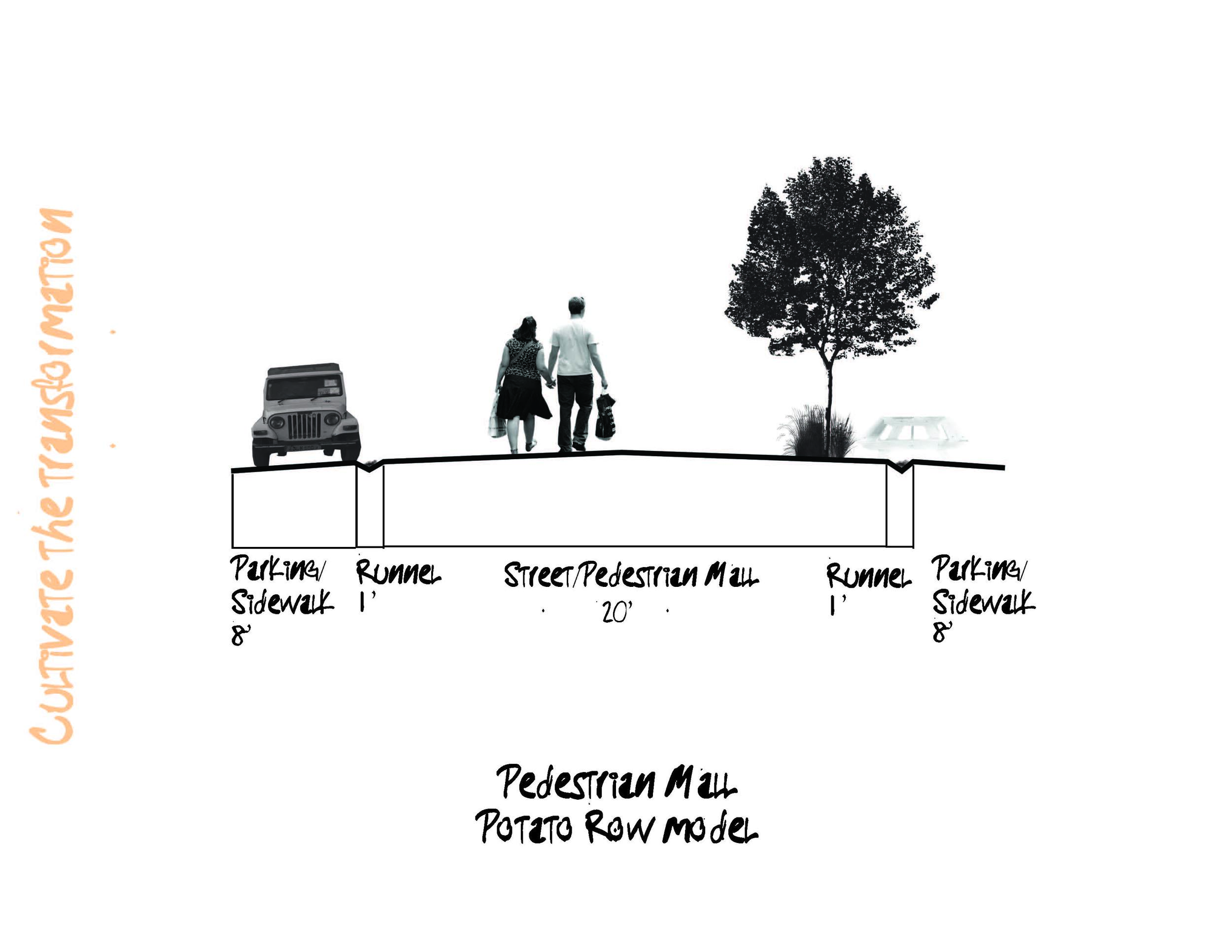
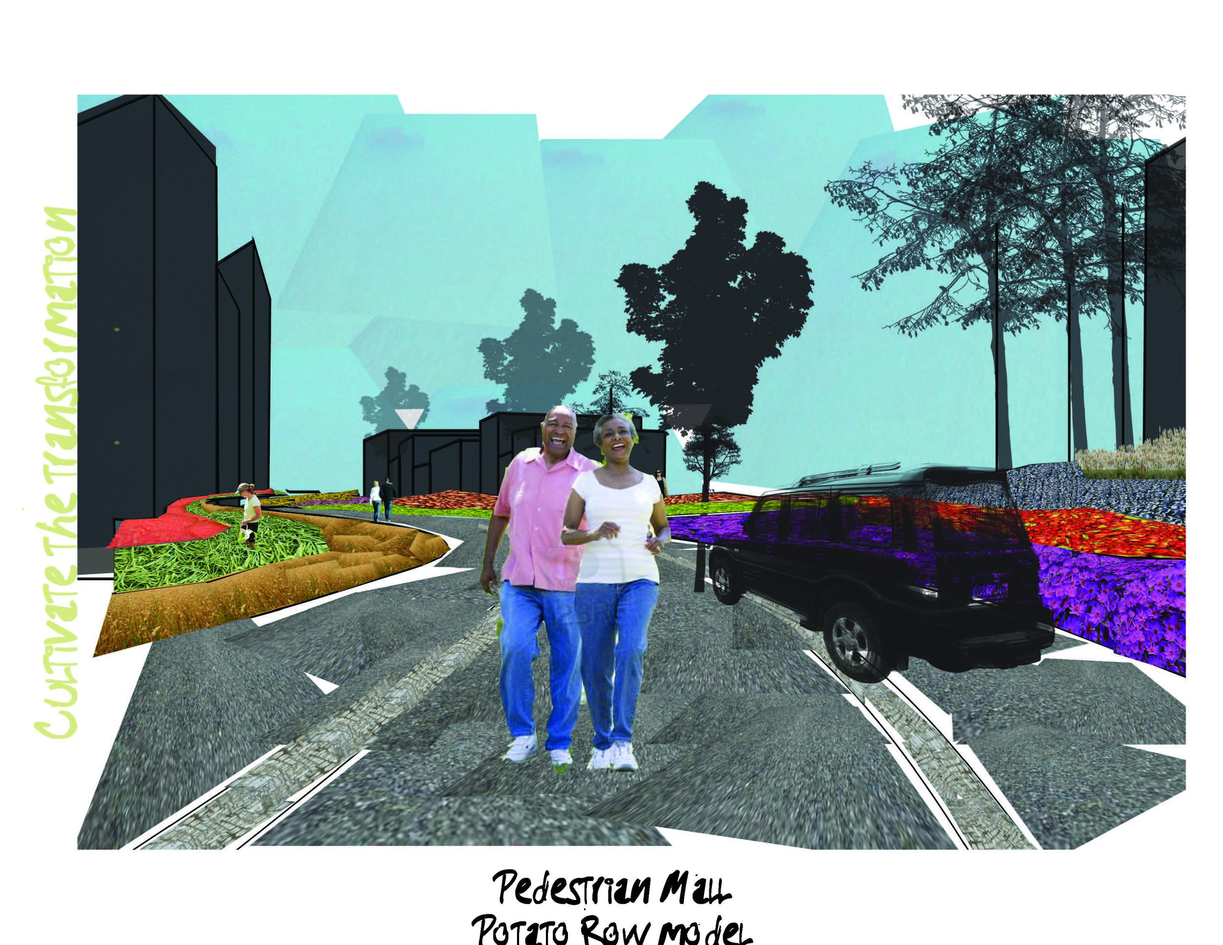
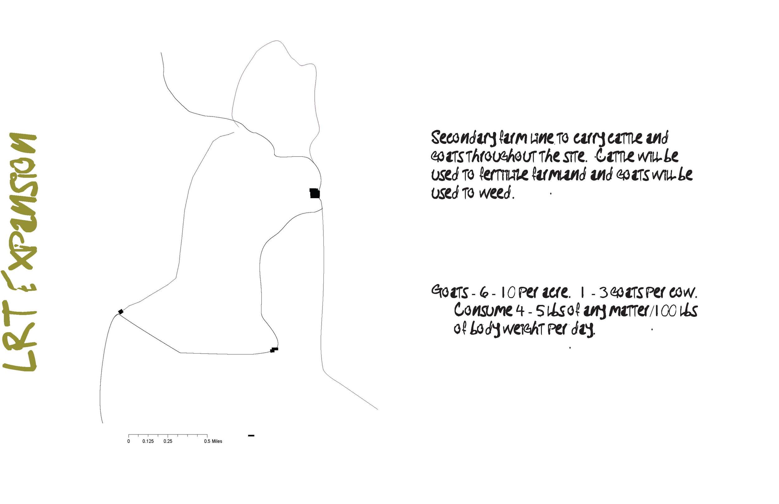
A new LRT station is located within a residential and commercial zone, which follows the model of the Potato Rows in Copenhagen: narrow streets which exist mainly as pedestrian malls but also allow for parking as necessary. A secondary LRT line is purposed only for the transport of animals allowing for the transport of goats to various parts of the site to act as weeding agents, as well as to move cattle from the farm to meat processors.
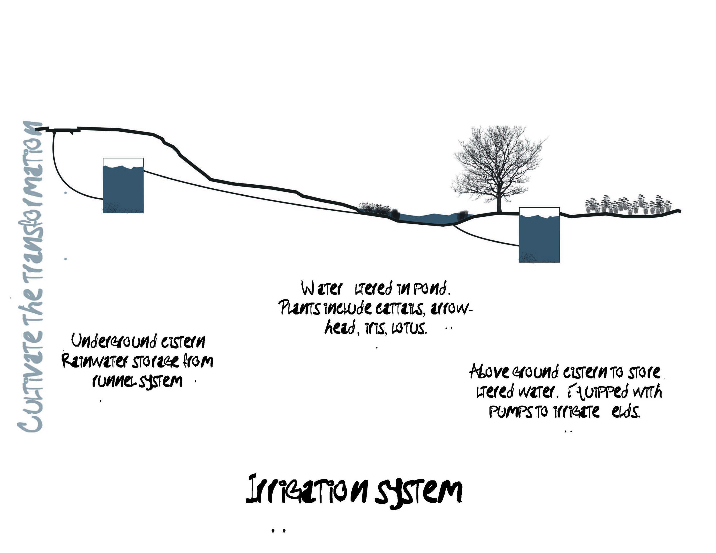
An irrigation system is set up through the collection of rainwater in underground cisterns and pumping stations.